![]()

$6.99
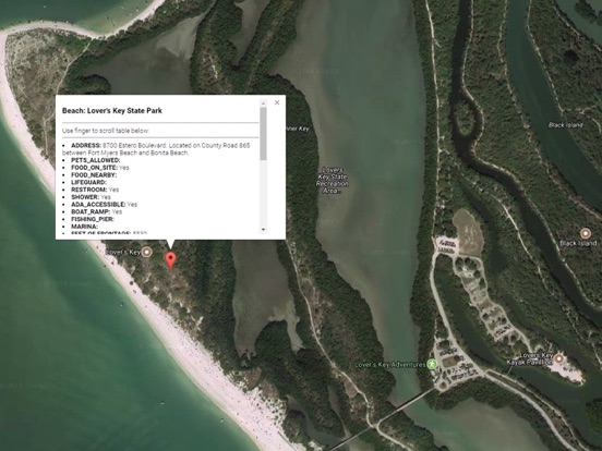
Florida Boat Ramps & Tides
Accurate, simple to use Satellite Map based Florida Boat Ramps of all FWC public boat ramps. Designed by Florida Tournament fishermen and Professional Florda Fishing Guides. Find a functional boat ramp and discover good fishing grounds with the Satellite Map all from one app.
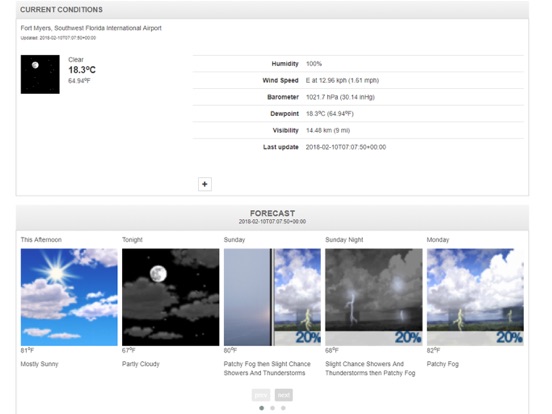
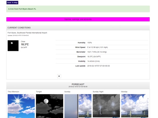
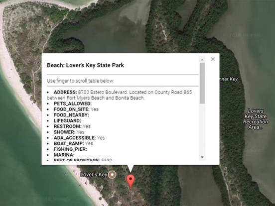
Satellite Map based Florida tide charts of the all NOAA based Florida tide stations on a simple to use satellite map WITH WEATHER!
NO SPAM ADS, SIMPLE TO USE...100% NO SPAM ADS.
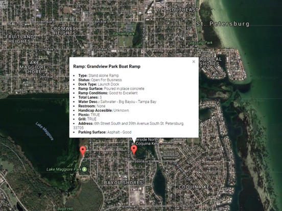
Features the most complete information about any Boat Ramp including:
Dock Type
Ramp Surface
Ramp Conditions
Waterway Type (Freshwater or Salt)
Waterway Name
Total Lanes
Dock Type
Parking Lot Surface
Parking Lot Condition
Trailer
Restroom
Handicap Access
Picnic
Lighting
Grill
Street, City, County, Zip
Other Features:
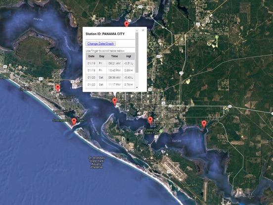
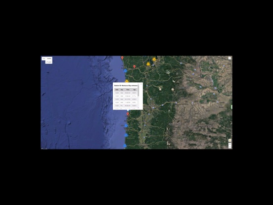
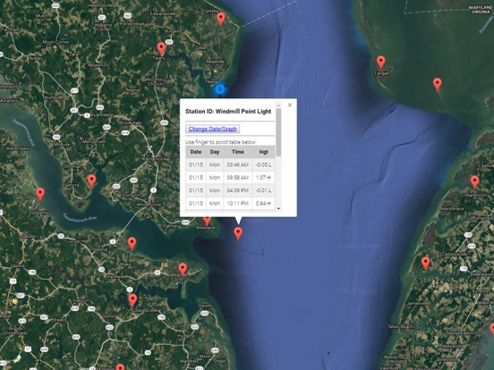
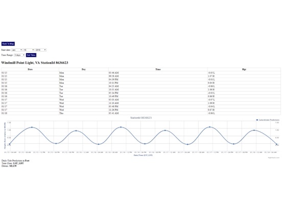
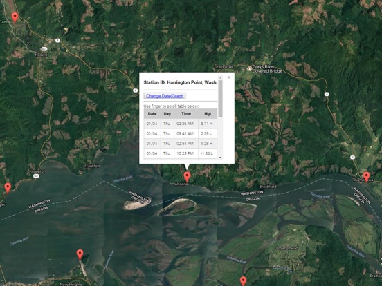
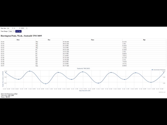
Ability to forecast Florida tides from NOAA by setting date and period for any of the tidal stations for the entire State of Florida tide tables.
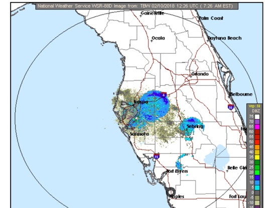
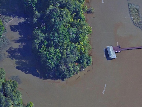
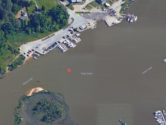
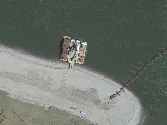
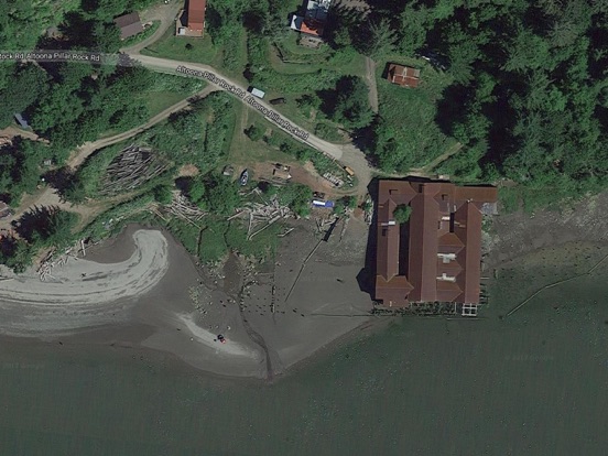
Included is the ability to zoom and view satellite imagery for fishing ground characteristics to compare with tide movement.
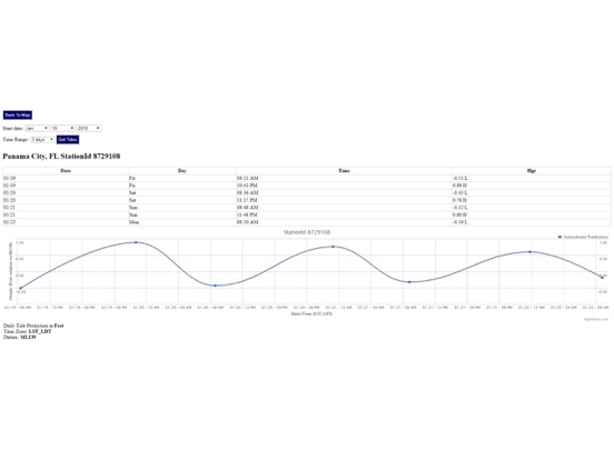
Advanced tide graphs allow for you to judge the level of water movement for optimal fishing between high and low tide in Florida between tide stations so you can follow the tide flow for the entire day.
Auto saves your map location so you can return quickly the next time you use the boat ramp app.
Excellent support for any issues, questions or new features...simply email: [email protected] and we'll show you how Apple support is meant to be.
Included is the ability to zoom and view satellite imagery for fishing ground characteristics to compare with tide movement.
Recent Feedback:
"The ability to display real-time status of boat ramps allows me to extend fishing trips by choosing a boat ramp that is safe & fully functional. The satellite view allows me to explore and discover new fishing grounds I never knew existed near those boat ramps. Absolutely the best fishing software tool I have ever used. ," said USCG Captain Mike K.