Tide Apps for iPhone and Android - Fishing Tides

Tidal Apps for Fishing & Inshore Boating

  • Home
  • FREE Decal
  • Tides for Android
  • Tides for iPhone
  • Florida Tides
  • Tides by Region
  • Contact

New Jersey Tide Chart

by Skiff Life Join Discussion

App Icon
View in iTunes
$4.99

New Jersey Tide Chart

Accurate, simple to use Satellite Map based New Jersey tide charts of the all NOAA based New Jersey tide stations on a simple to use satellite map. Designed by New Jersey fishermen and Professional New Jersey Fishing Guides.

NO SPAM ADS, SIMPLE TO USE...100% AD FREE.

Other Features:

Ability to forecast New Jersey tides from NOAA by setting date and period for any of the tidal stations for the entire State of New Jersey tide tables.

Excellent support for any issues, questions or new features...simply email: [email protected] and we'll show you how Apple support is meant to be.

Auto-save last location for easy reference to your last tide station the next time you use the tide app.

Included is the ability to zoom and view satellite imagery for fishing ground characteristics to compare with tide movement.

Advanced tide graphs allow for you to judge the level of water movement for optimal fishing between high and low tide in New Jersey between tide stations so you can follow the tide flow for the entire day.

Recent Feedback:
"NesTides ability to display tide predictions and actual tidal flow graphs allow me to extend fishing trips by following different tide station tide charts and moving with the tide flow. The satellite view allows me to explore and discover new fishing grounds I never knew existed. Absolutely the best fishing software tool I have ever used. ," said USCG Captain Mike K.

New Jersey Tide Chart stations include (partial list see website for full list):

Atlantic Highlands,SANDY HOOK (Fort Hancock),Highlands, Route 36 bridge,Oceanic Bridge, Navesink River,Red Bank, Navesink River,Sea Bright,Gooseneck Point, bridge,Long Branch Reach,Shark River Island, fixed RR. bridge,Shark River Hills,New Bedford,Long Branch (fishing pier),Belmar, Atlantic Ocean,Manasquan Inlet, USCG Station,Brielle, Route 35 bridge,Riviera Beach,Beaverdam Creek entrance,Beaverdam Creek, inside,Forge Pond,Tall Pines Camp,Seaside Heights, ocean,Mantoloking,Kettle Creek, Green Island,Ocean Beach,Silver Bay, Silver Bay Marina,Goose Creek entrance,Coates Point,Toms River (town), Toms River,Seaside Park,Barnegat Pier,Sloop Creek,Cedar Creek,Island Beach,Stouts Creek,Forked River,Oyster Creek,Island Beach, Sedge Islands,Waretown,Barnegat Inlet, USCG Station,High Bar,Double Creek,Loveladies Harbor,Flat Creek,North Beach,Manahawkin Creek,Manahawkin Drawbridge,Mill Creek, 1 n.mi. above entrance,Cedar Run,upper end,Beach Haven Crest,Westecunk Creek entrance,West Creek, Westecunk Creek,Parker Run, upper end,Tuckerton Creek entrance,Tuckerton, Tuckerton Creek,Beach Haven Coast Guard Station,Shooting Thorofare, Little Egg Inlet,Little Sheepshead Creek,Seven Island, Newmans Thorofare,Graveling Point,Nacote Creek,Tuckahoe River,Cedar Swamp Creek, Tuckahoe River,River Bend Marina, Great Egg Harbor River,Mays Landing, Great Egg Harbor River,Strathmere, Strathmere Bay,Middle Thorofare, Ocean Drive bridge,Ludlam Bay, west side,Ocean Drive bridge,Townsend Sound,Stites Sound,Ingram Thorofare,Long Reach, Ingram Thorofare,Stone Harbor, Great Channel,Nummy Island, Grassy Sound Channel,West Wildwood, Grassy Sound,Old Turtle Thorofare, RR. bridge,Wildwood Crest, ocean pier,Swain Channel, Taylor Sound,Wildwood Crest, Sunset Lake,Cape May Harbor,Cape Island Creek, Cape May,Cape May, Atlantic Ocean,Brandywine Shoal Light,Cape May Point, Sunset Beach,Cape May, ferry terminal,North Highlands Beach,Dias Creek, Route 47 bridge,Bidwell Creek entrance,Bidwell Creek,Dennis Creek,Dennis Creek, Route 47 bridge,West Creek,Maurice River Cove,Bivalve,Mauricetown,Port Elizabeth, Manumuskin River,Menantico Creek entrance,Millville,Dividing Creek entrance,Weir Creek bridge, Dividing Creek,Fishing Creek entrance,Fortescue Creek,Hollywood Beach, The Glades,Money Island, Nantuxent Creek entrance,Newport Landing, Nantuxent Creek,Cedar Creek entrance, Nantuxent Cove,Back Creek entrance, Nantuxent Cove,Ship John Shoal,Greenwich Pier, Cohansey River,Tindalls Wharf, Cohansey River

  • App Screenshot
  • App Screenshot
  • App Screenshot
  • App Screenshot

Filed Under: Tide Chart Apps Tagged With: high tide chart, high tide today, high-tide, low tide, low tide today, noaa tides, saltwater tides, tide chart, tide chart near me, tide chart nj, tide finder, tide schedule, tide tables, tides, tides for fishing, tides near me, tides today

New Hampshire Tide Chart

by Skiff Life Join Discussion

App Icon
View in iTunes
$4.99

New Hampshire Tide Chart

Accurate, simple to use Satellite Map based New Hampshire tide charts of the all NOAA based New Hampshire tide stations on a simple to use satellite map. Designed by New Hampshire fishermen and Professional New Hampshire Fishing Guides.

NO SPAM ADS, SIMPLE TO USE...100% AD FREE.

Other Features:

Ability to forecast New Hampshire tides from NOAA by setting date and period for any of the tidal stations for the entire State of New Hampshire tide tables.

Excellent support for any issues, questions or new features...simply email: [email protected] and we'll show you how Apple support is meant to be.

Auto-save last location for easy reference to your last tide station the next time you use the tide app.

Included is the ability to zoom and view satellite imagery for fishing ground characteristics to compare with tide movement.

Advanced tide graphs allow for you to judge the level of water movement for optimal fishing between high and low tide in New Hampshire between tide stations so you can follow the tide flow for the entire day.

Recent Feedback:
"NesTides ability to display tide predictions and actual tidal flow graphs allow me to extend fishing trips by following different tide station tide charts and moving with the tide flow. The satellite view allows me to explore and discover new fishing grounds I never knew existed. Absolutely the best fishing software tool I have ever used. ," said USCG Captain Mike K.

New Hampshire Tide Chart stations include (partial list see website for full list):

Jaffrey Point, Gerrish Island, Fort Point, Kittery Point, Seavey Island, Portsmouth, Atlantic Heights, Dover Point, Dover, Cocheco River, Salmon Falls River, Squamscott River RR. Bridge, Gosport Harbor, Isles of Shoals, Hampton Harbor

  • App Screenshot
  • App Screenshot
  • App Screenshot
  • App Screenshot

Filed Under: Tide Chart Apps Tagged With: high tide chart, high tide today, high-tide, low tide, low tide today, noaa tides, tide chart, tide chart near me, tide finder, tide schedule, tide tables, tides, tides near me, tides today

Mississippi Tide Chart

by Skiff Life Join Discussion

App Icon
View in iTunes
$4.99

Mississippi Tide Chart

Accurate, simple to use Satellite Map based Mississippi tide charts of the all NOAA based Mississippi tide stations on a simple to use satellite map. Designed by Mississippi fishermen and Professional Mississippi Fishing Guides.

NO SPAM ADS, SIMPLE TO USE...100% AD FREE.

Other Features:

Ability to forecast Mississippi tides from NOAA by setting date and period for any of the tidal stations for the entire State of Mississippi tide tables.

Excellent support for any issues, questions or new features...simply email: [email protected] and we'll show you how Apple support is meant to be.

Auto-save last location for easy reference to your last tide station the next time you use the tide app.

Included is the ability to zoom and view satellite imagery for fishing ground characteristics to compare with tide movement.

Advanced tide graphs allow for you to judge the level of water movement for optimal fishing between high and low tide in Mississippi between tide stations so you can follow the tide flow for the entire day.

Recent Feedback:
"NesTides ability to display tide predictions and actual tidal flow graphs allow me to extend fishing trips by following different tide station tide charts and moving with the tide flow. The satellite view allows me to explore and discover new fishing grounds I never knew existed. Absolutely the best fishing software tool I have ever used. ," said USCG Captain Mike K.

Mississippi Tide Chart stations include (partial list see website for full list):

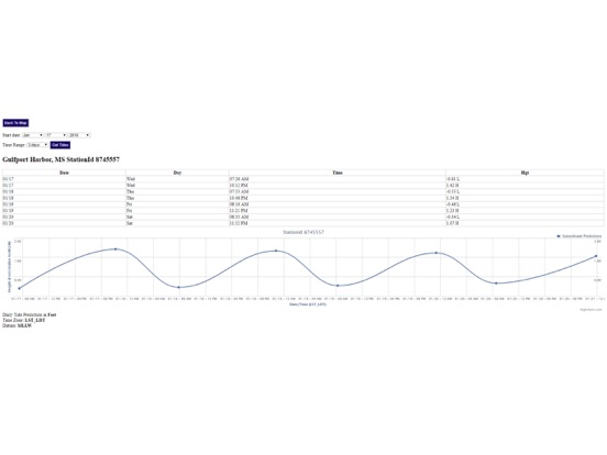
Grand Bay NERR, Mississippi Sound,Point of Pines, Bayou Cumbest,Hollingsworth Point, Davis Bayou,Petit Bois Island, Mississippi Sound,Ship Island, Mississippi Sound,Horn Island, Mississippi Sound,Dock E, Port of Pascagoula,Pascagoula, Mississippi Sound,Graveline Bayou Entrance,Gulfport Harbor, Mississippi Sound,Biloxi (Cadet Point), Biloxi Bay,Turkey Creek, Bernard Bayou,Handsboro Bridge, Bernard Bayou,Cat Island,Pass Christian Yacht Club, Mississippi Sound,Wolf River, Henderson Avenue bridge,St. Louis Bay entrance,Waveland,Pearlington, Pearl River,Alabama Point,Mobile Point (Fort Morgan),Gulf Shores, ICWW,Bon Secour, Bon Secour River,DAUPHIN ISLAND,East Fowl River, Hwy 193 Bridge,West Fowl River, Hwy 188 bridge,Point Clear, Mobile Bay,Dog River Bridge,Coast Guard Sector Mobile,Meaher State Park, Mobile Bay,MOBILE, Mobile River (State Dock),William Brooks Park, Chichasaw Creek,Lower Hall Landing, Tensaw River,Bayou La Batre, Mississippi Sound,Bayou LaBatre Bridge

  • App Screenshot
  • App Screenshot
  • App Screenshot
  • App Screenshot

Filed Under: Tide Chart Apps Tagged With: high tide today, noaa tides, tide chart, tide chart near me, tide finder, tide schedule, tide tables, tides, tides near me, tides today

Massachusetts Tide Chart

by Skiff Life Join Discussion

App Icon
View in iTunes
$4.99

Massachusetts Tide Chart

Accurate, simple to use Satellite Map based Massachusetts tide charts of the all NOAA based Massachusetts tide stations on a simple to use satellite map. Designed by Massachusetts fishermen and Professional Massachusetts Fishing Guides.

NO SPAM ADS, SIMPLE TO USE...100% AD FREE.

Other Features:

Ability to forecast Massachusetts tides from NOAA by setting date and period for any of the tidal stations for the entire State of Massachusetts tide tables.

Excellent support for any issues, questions or new features...simply email: [email protected] and we'll show you how Apple support is meant to be.

Auto-save last location for easy reference to your last tide station the next time you use the tide app.

Included is the ability to zoom and view satellite imagery for fishing ground characteristics to compare with tide movement.

Advanced tide graphs allow for you to judge the level of water movement for optimal fishing between high and low tide in Massachusetts between tide stations so you can follow the tide flow for the entire day.

Recent Feedback:
"NesTides ability to display tide predictions and actual tidal flow graphs allow me to extend fishing trips by following different tide station tide charts and moving with the tide flow. The satellite view allows me to explore and discover new fishing grounds I never knew existed. Absolutely the best fishing software tool I have ever used. ," said USCG Captain Mike K.

Massachusetts Tide Chart stations include (partial list see website for full list):

Plum Island, Merrimack River Entrance, Newburyport, Salisbury Point, Merrimacport, Riverside, Plum Island Sound (south end), Essex, Annisquam, Lobster Cove, Rockport, Gloucester Harbor, Salem, Salem Harbor, Lynn, Lynn Harbor, Boston Light, Deer Island (south end), BOSTON, Charlestown, Charles River entrance, Amelia Earhart Dam, Mystic River, Chelsea St. Bridge, Chelsea River, Neponset, Neponset River, Moon Head, Nut Island, Quincy Bay, Weymouth Fore River Bridge, Crow Point, Hingham Harbor entrance, Hingham, Nantasket Beach, Weir River, Hull, Cohasset Harbor (White Head), Scituate, Scituate Harbor, Damons Point, North River, Brant Rock, Green Harbor River, Duxbury, Duxbury Harbor, Plymouth, Cape Cod Canal, Sagamore, Cape Cod Canal, Bournedale, Cape Cod Canal, Bourne Bridge, Sandwich Marina, Cape Cod Canal, east entrance, Barnstable Harbor, Beach Point, Sesuit Harbor, East Dennis, Wellfleet, Provincetown, Chatham, Stage Harbor, Chatham Harbor, Aunt Lydias Cove, Pleasant Bay, Georges Shoal, Texas Tower, Saquatucket Harbor, Wychmere Harbor, Dennisport, South Yarmouth, Bass River, Hyannis Port, Cotuit Highlands, Poponesset Island, Poponesset Bay, Falmouth Heights, Great Point, NANTUCKET, Eel Point, Muskeget Island, north side, Wasque Point, Chappaquiddick Island, Martha's Vineyard GPS Buoy, Squibnocket Point, Nomans Land, Gay Head, Cedar Tree Neck, VINEYARD HAVEN, VINEYARD HVN HBR, Oak Bluffs, Edgartown, Little Harbor, OCEANOGRAPHIC INSTITUTION, Uncatena Island (south side), Quicks Hole, North side, Cuttyhunk, Penikese Island, Chappaquoit Point, West Falmouth Harbor, Monument Beach, Gray Gables, Cape Cod Canal, RR. bridge, Onset Beach, Onset Bay, Great Hill, Marion, Sippican Harbor, Piney Point, Mattapoisett, Mattapoisett Harbor, Clarks Point, New Bedford, Round Hill Point, Westport Harbor, Hix Bridge, East Branch

  • App Screenshot
  • App Screenshot
  • App Screenshot
  • App Screenshot

Filed Under: Tide Chart Apps Tagged With: boston tides, high-tide, low tide, ma tides, saltwater tides, tide chart, tide chart cape cod, tide chart ma, tide chart near me, tide finder, tide schedule, tides

Maryland Tide Chart & Weather

by Skiff Life Join Discussion

App Icon
View in iTunes
$4.99

Maryland Tide Chart & Weather

Accurate, simple to use Satellite Map based Maryland tide charts of the all NOAA based Maryland tide stations on a simple to use satellite map. Designed by Maryland fishermen and Professional Maryland Fishing Guides.

NO SPAM ADS, SIMPLE TO USE...100% AD FREE.

Other Features:

Ability to forecast Maryland tides from NOAA by setting date and period for any of the tidal stations for the entire State of Maryland tide tables.

Excellent support for any issues, questions or new features...simply email: [email protected] and we'll show you how Apple support is meant to be.

Auto-save last location for easy reference to your last tide station the next time you use the tide app.

Included is the ability to zoom and view satellite imagery for fishing ground characteristics to compare with tide movement.

Advanced tide graphs allow for you to judge the level of water movement for optimal fishing between high and low tide in Maryland between tide stations so you can follow the tide flow for the entire day.

Recent Feedback:
"NesTides ability to display tide predictions and actual tidal flow graphs allow me to extend fishing trips by following different tide station tide charts and moving with the tide flow. The satellite view allows me to explore and discover new fishing grounds I never knew existed. Absolutely the best fishing software tool I have ever used. ," said USCG Captain Mike K.

Maryland Tide Chart stations include (partial list see website for full list):
OCEAN CITY (FISHING PIER),Ocean City Inlet,Ocean City (Isle of Wight Bay),Keydash, Isle of Wight Bay,Assateague Beach, Toms Cove,Harbor of Refuge,Chincoteague Channel (south end),Wishart Point, Bogues Bay,Chincoteague Island, USCG Station,Chincoteague Island, Lewis Creek,Chincoteague Island, Oyster Bay,Chincoteague Island, Blake Cove,Jesters Island,Franklin City,Buntings Bridge,Public Landing,South Point, Sinepuxent Neck,Saxis, Starling Creek, Pocomoke Sound,Ape Hole Creek, Pocomoke Sound,Shelltown,Snowhill, city park,Crisfield, Little Annemessex River,Colburn Creek, Big Annemessex River,Long Point, Big Annemessex River,Teague Creek, Manokin River,Ewell, Smith Island,Holland Island Bar Light,Chance,Sharkfin Shoal Light,Great Shoals Light, Monie Bay,Whitehaven,Salisbury,Roaring Point,Vienna,Sharptown,McCreedy's Creek, Fishing Bay,Hooper Strait Light,Bishops Head, Hooper Strait,Middle Hooper Island,Barren Island,Smithville Road Bridge, Beaverdam Creek,Taylors Island, Slaughter Creek,Woolford, Church Creek,Cherry Island, Beckwiths Creek,Cambridge,Dover Bridge,Hillsboro, Tuckahoe Creek,Oxford,Easton Point,Deep Neck Point, Broad Creek,St. Michaels, San Domingo Creek,Avalon, Claiborne, Eastern Bay,St. Michaels, Miles River,Kent Island Narrows,Love Point,Queenstown,Centreville Landing, Corsica River,Cliffs Point,Cliffs Wharf,Chestertown,Crumpton,Matapeake, Kent Island,Kent Point Marina,Deep Landing, Swan Creek,Tolchester Beach,Worton Creek entrance,Sassafras River, Betterton,Town Point Wharf,Old Frenchtown Wharf,Charlestown, Northeast River,Havre de Grace,Port Deposit,Pond Point, Bush River,North Point,Stony Creek,Hawkins Point,BALTIMORE, Fort McHenry,Fort McHenry Marsh,Mountain Point, Magothy River,Cornfield Creek, Magothy River,Brewer Point,Annapolis (US Naval Academy),Thomas Point Shoal Light,Edgewater, South River,Gingerville Creek, South River,Rhode River (County Wharf),Galesville, West River,Rose Haven,Chesapeake Beach,Long Beach,Cove Point,Solomons Island,Broomes Island,Benedict,Md.,Colonial Beach, Va.,Dahlgren, Upper Machodoc Creek, Va.,Lower Cedar Point, Md.,Mathias Point, Va.,Goose Creek, Port Tobacco River, Md.,Riverside, Md.,Aquia Creek, Va.,Clifton Beach, Smith Point, Md.,Liverpool Point, Md.,Quantico, Va.,Indian Head, Md.,Marshall Hall, Md.,Alexandria, Va.,Bellevue, D.C.,WASHINGTON, Washington Channel, D.C.,Washington Naval Yard,Kingman Lake,Kenilworth Aquatic Garden,Bladensburg, Md.

  • App Screenshot
  • App Screenshot
  • App Screenshot
  • App Screenshot

Filed Under: Tide Chart Apps Tagged With: high-tide, low tide, saltwater tides, tide chart, tide chart near me, tide finder, tide schedule

Alabama Tide Chart & Weather

by Skiff Life 2 Comments

App Icon
View in iTunes
$4.99

Alabama Tide Chart & Weather

Accurate, simple to use Satellite Map based Alabama tide charts of the all NOAA based Alabama tide stations on a simple to use satellite map. Designed by Alabama fishermen and Professional Alabama Fishing Guides.

NO SPAM ADS, SIMPLE TO USE...100% AD FREE.

Other Features:

Ability to forecast Alabama tides from NOAA by setting date and period for any of the tidal stations for the entire State of Alabama tide tables.

Excellent support for any issues, questions or new features...simply email: [email protected] and we'll show you how Apple support is meant to be.

Auto-save last location for easy reference to your last tide station the next time you use the tide app.

Included is the ability to zoom and view satellite imagery for fishing ground characteristics to compare with tide movement.

Advanced tide graphs allow for you to judge the level of water movement for optimal fishing between high and low tide in Alabama between tide stations so you can follow the tide flow for the entire day.

Recent Feedback:
"NesTides ability to display tide predictions and actual tidal flow graphs allow me to extend fishing trips by following different tide station tide charts and moving with the tide flow. The satellite view allows me to explore and discover new fishing grounds I never knew existed. Absolutely the best fishing software tool I have ever used. ," said USCG Captain Mike K.

Alabama Tide Chart stations include (partial list see website for full list):

Alabama Point,Mobile Point (Fort Morgan),Gulf Shores, ICWW,Bon Secour, Bon Secour River,DAUPHIN ISLAND,East Fowl River, Hwy 193 Bridge,West Fowl River, Hwy 188 bridge,Point Clear, Mobile Bay,Dog River Bridge,Coast Guard Sector Mobile,Meaher State Park, Mobile Bay,MOBILE, Mobile River (State Dock),William Brooks Park, Chichasaw Creek,Lower Hall Landing, Tensaw River,Bayou La Batre, Mississippi Sound,Bayou LaBatre Bridge,Grand Bay NERR, Mississippi Sound,Point of Pines, Bayou Cumbest,Hollingsworth Point, Davis Bayou,Petit Bois Island, Mississippi Sound,Ship Island, Mississippi Sound,Horn Island, Mississippi Sound,Dock E, Port of Pascagoula,Pascagoula, Mississippi Sound,Graveline Bayou Entrance,Gulfport Harbor, Mississippi Sound,Biloxi (Cadet Point), Biloxi Bay,Turkey Creek, Bernard Bayou,Handsboro Bridge, Bernard Bayou,Cat Island,Pass Christian Yacht Club, Mississippi Sound,Wolf River, Henderson Avenue bridge,St. Louis Bay entrance,Waveland,Pearlington, Pearl River

  • App Screenshot
  • App Screenshot
  • App Screenshot
  • App Screenshot

Filed Under: Tide Chart Apps Tagged With: high tide today, high-tide, low tide, orange beach tide chart, saltwater tides, tide chart, tide schedule, tide tables, tides, tides for fishing

  • « Previous Page
  • 1
  • 2
  • 3

Choose Your Device:

android app iphone app

RSS Fishing News

Tides For Fishing

Tides for Fishing

© 2023 · Skiff Life. All Rights Reserved. Third party names and products are for reference purposes only, all rights are reserved by these respective parties.