![]()

$4.99
Texas Tides by NOAA
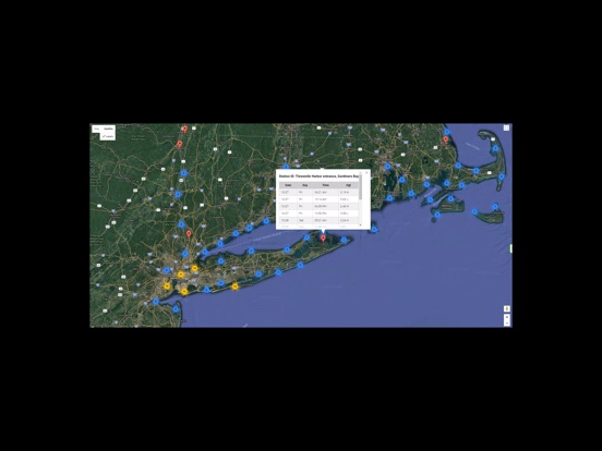
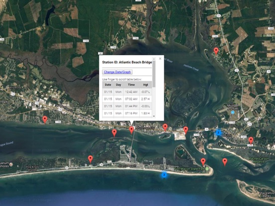
Easy to use tide charts displayed on a Satellite Map for the entire State of Texas and extended over to Louisiana for convenience on a simple to use satellite map. Designed by fishermen and fishing guides.
NO SPAM ADS, SIMPLE TO USE...100% AD FREE.
This edition covers the following state's tide charts: Texas tides, Louisiana tides.
Other Features:
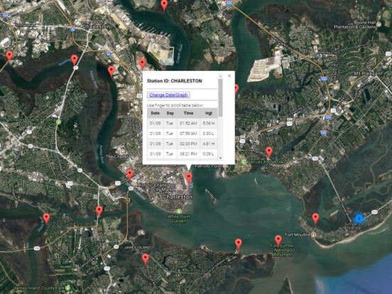
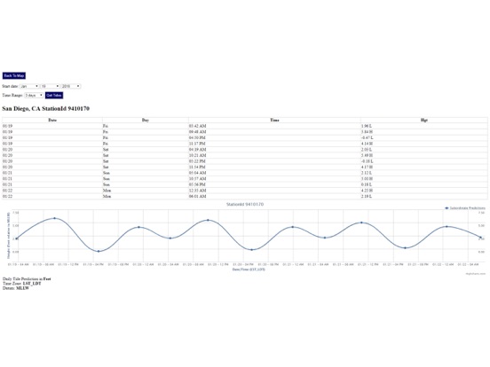
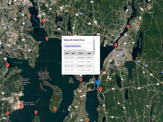
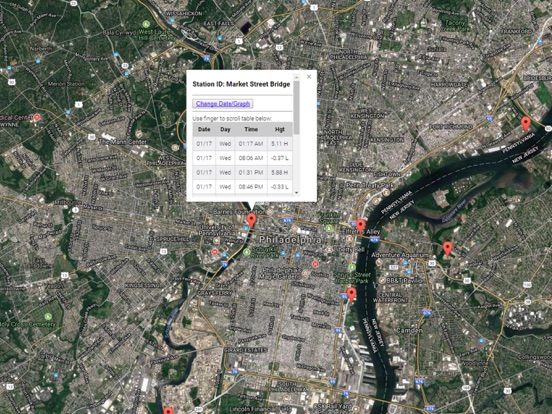
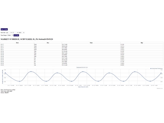
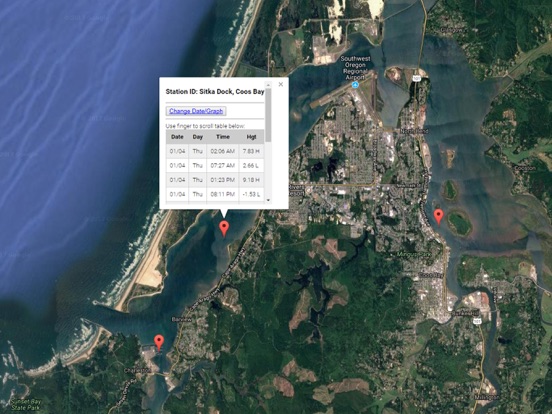
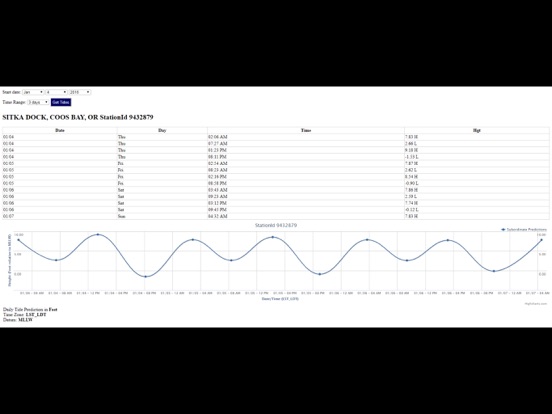
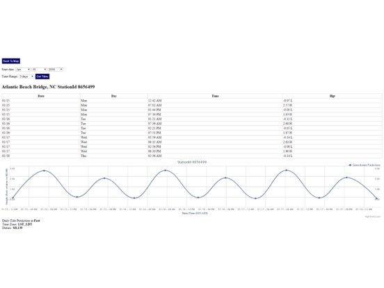
Easy to Use, advanced tide graphs allow for you to judge the level of water movement for optimal fishing between high and low tide.
Ability to forecast tides from NOAA by setting date and period for any of the tidal stations for the entire Gulf of Mexico including: Texas, Louisiana.
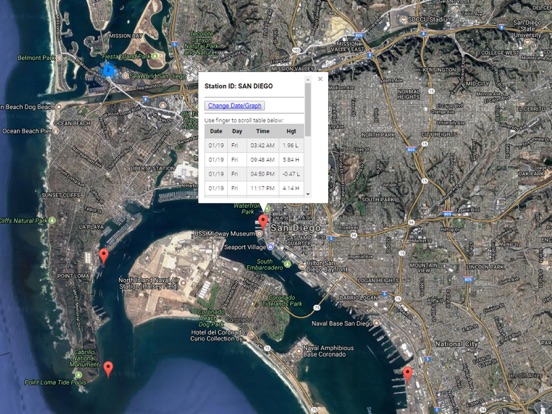
Auto-saves your last position and zoom to the map for surrounding NOAA tide stations.
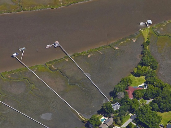
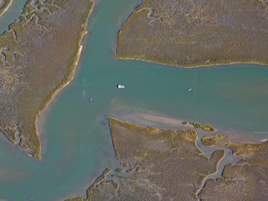
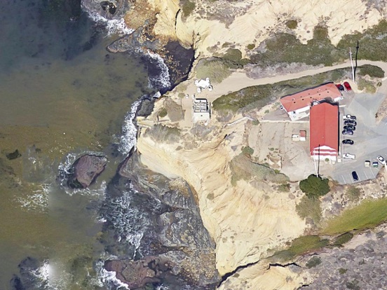
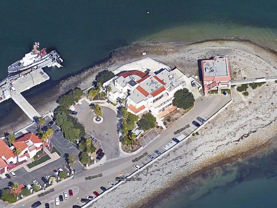
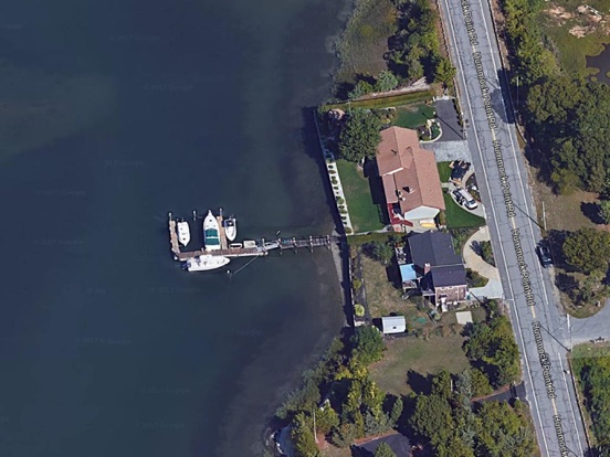
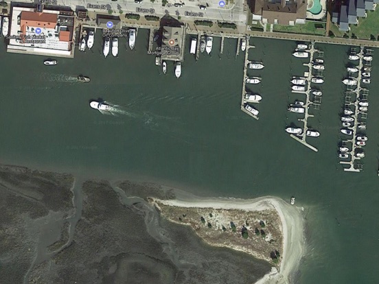
Included is the ability to zoom and view satellite imagery for fishing ground characteristics to compare with tide movement.
Tide Stations Include:
Sabine Pass tides
Texas Point, Sabine Pass tide times
Port Arthur tides
Rainbow Bridge tide times
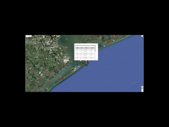
Galveston Bay entrance, south jetty tides
GALVESTON, Galveston Channel tide times
Port Bolivar tides
Texas City, Turning Basin tide times
Eagle Point tides
Clear Lake tide times
Morgans Point, Barbours Cut tides
Lynchburg Landing, San Jacinto River tide times
Manchester, Houston Ship Channel tides
Round Point, Trinity Bay tide times
Umbrella Point, Trinity Bay tides
Point Barrow, Trinity Bay tide times
Rollover Pass tides
High Island, ICWW tide times
Gilchrist, East Bay tides
Jamaica Beach, West Bay tide times
Alligator Point, West Bay tides
San Luis Pass tide times
Christmas Bay tides
Galveston Pleasure Pier tide times
Sargent, ICWW tides
Freeport Harbor tide times
East Matagorda tides
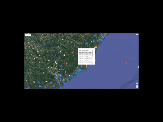
Aransas Wildlife Refuge tide times
Matagorda Bay Entrance Channel tides
PORT O'CONNOR, MATAGORDA BAY tide times
Nueces Bay tides
Aransas, Aransas Pass tide times
Corpus Christi tides
Packery Channel tide times
South Padre Island, Brazos Santiago Pass tides
PADRE ISLAND (south end) tide times
Queen Isabella Causeway (east end) tides
Queen Isabella Causeway (west end) tide times
Port Isabel tides
South Bay entrance tide times
The Rigolets, U.S. Highway 90 tides
Bayou BonFouca, Route 433 tide times
Tchefuncta River, Lake Pontchartrain tides
New Canal USCG station, Lake Pontchartrain tide times
Chef Menteur, Chef Menteur Pass tides
Michoud Substation, ICWW tide times
Shell Beach, Lake Borgne tides
Grand Pass tide times
Chandeleur Light tides
Comfort Island tide times
Bay Gardene tides
Breton Islands tide times
Jack Bay tides
Lonesome Bayou (Thomasin) tide times
Grand Bay tides
North Pass, Pass a Loutre tide times
Venice, Grand Pass tides
Pilottown tide times
Southeast Pass tides
SOUTH PASS tide times
Port Eads, South Pass tides
Southwest Pass tide times
Joseph Bayou tides
Paris Road Bridge (ICWW) tide times
Empire Jetty tides
Bastian Island tide times
Quatre Bayous Pass tides
Barataria Pass tide times
EAST POINT, GRAND ISLE tides
Bayou Rigaud, Grand Isle tide times
Independence Island tides
Manilla tide times
Lafitte, Barataria Waterway tides
Caminada Pass (bridge) tide times
Port Fourchon tides
Leeville, Bayou LaFourche tide times
Timbalier Island, Timbalier Bay tides
East Timbalier Island, Timbalier Bay tide times
Pelican Islands, Timbalier Bay tides
Wine Island, Terrebonne Bay tide times
Cocodrie, Terrebonne Bay tides
E. ISLE DERNIERES, LAKE PELTO tide times
Caillou Boca tides
Raccoon Point, Caillou Bay tide times
Texas Gas Platform, Caillou Bay tides
Eugene Island, North of, Atchafalaya Bay tide times
Point Au Fer tides
Shell Island tide times
Stouts Pass at Six Mile Lake tides
Point Chevreuil tide times
Rabbit Island, 5 miles south of tides
South Point, Marsh Island tide times
Lighthouse Point tides
Ship Shoal Light tide times
Cote Blanche Island, West Cote Blanche Bay tides
Southwest Pass, Vermilion Bay tide times
Cypremort Point tides
Weeks Bay tide times
Freshwater Canal Locks tides
Mermentau River entrance tide times
Calcasieu Pass tides
Bulk Terminal tide times
Lake Charles tides